


Ashley Voting District, Independence County, Arkansas
About
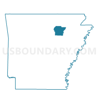
Outline

Summary
| Unique Area Identifier | 526685 |
| Name | Ashley Voting District |
| County | Independence County |
| State | Arkansas |
| Area (square miles) | 34.00 |
| Land Area (square miles) | 34.00 |
| Water Area (square miles) | 0.00 |
| % of Land Area | 100.00 |
| % of Water Area | 0.00 |
| Latitude of the Internal Point | 35.84805010 |
| Longtitude of the Internal Point | -91.62781890 |
Maps


Graphs
Select a template below for downloading or customizing gragh for Ashley Voting District, Independence County, Arkansas


Neighbors
Neighoring Voting District (by Name) Neighboring Voting District on the Map
- Barren Voting District, Independence County, AR
- Cushman-Union Voting District, Independence County, AR
- Gainsboro Voting District, Independence County, AR
- Jefferson Voting District, Independence County, AR
- Moorefield TWP Voting District, Independence County, AR
- Ruddell Rural Voting District, Independence County, AR
Top 10 Neighboring County Subdivision (by Population) Neighboring County Subdivision on the Map
- Ruddell township, Independence County, AR (10,164)
- Moorefield township, Independence County, AR (2,880)
- Barren township, Independence County, AR (1,483)
- Ashley township, Independence County, AR (1,441)
- Cushman-Union township, Independence County, AR (1,420)
- Gainsboro township, Independence County, AR (1,128)
- Jefferson township, Independence County, AR (205)
Top 10 Neighboring Unified School District (by Population) Neighboring Unified School District on the Map
Top 10 Neighboring State Legislative District Lower Chamber (by Population) Neighboring State Legislative District Lower Chamber on the Map
- State House District 72, AR (28,138)
- State House District 71, AR (26,638)
- State House District 73, AR (26,277)
Top 10 Neighboring State Legislative District Upper Chamber (by Population) Neighboring State Legislative District Upper Chamber on the Map
Top 10 Neighboring 111th Congressional District (by Population) Neighboring 111th Congressional District on the Map
Top 10 Neighboring Census Tract (by Population) Neighboring Census Tract on the Map
- Census Tract 4901, Independence County, AR (6,263)
- Census Tract 4903, Independence County, AR (6,149)
- Census Tract 4906, Independence County, AR (2,830)
- Census Tract 4902, Independence County, AR (2,457)